John Cary(1754-1835)
Published September 1st 1787. John Cary Arundel Street Strand
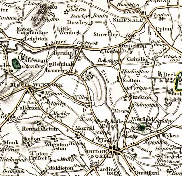
This is probably the first accurate survey of the whole of Shropshire, including
Broseley. A detailed map of the Broseley Estate had been made in the 18th Century
but this only covered the Eastern part of the town from the Parish Church to Jackfield.
The map shows coal pits at Caughley to the South East of Broseley.
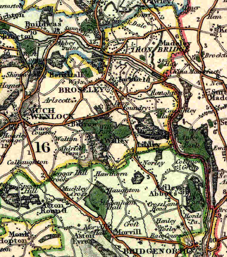
Greenwoods Map of 1830
Map of the County of Salop from an actual survey in 1826 and 1827.
Published February 24th 1830
The map was produced in colour at a scale of 3 miles to 1" and also in Black and White. It is much more detailed than Cary's map and shows features such as tramways running from Broseley to the Severn and also an Iron Foundry which was probably the Onions Foundry located in Foundry Lane.
Click on the map to download a colour version (80k).
1830 The next detailed survey was the Ordinance Survey 1" map
1836 Longman, Rees, Orme, brown & Co. Postmaster Row London Sept 1st 1836
Same scale and similar quality to Greenwoods map.1838 The first large scale survey of the whole district was the tithe map
-
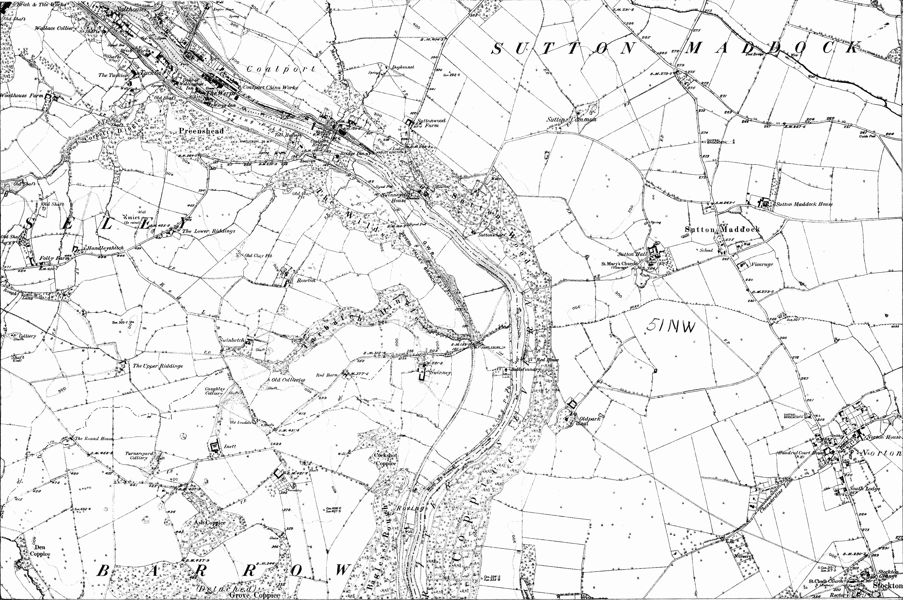
1882 1:10,000 (6") Map of the Broseley Area
-
51SE - covers Shirlett, Willey and the Smithies.
-
51SW - covers Linley, Colemore Green, Wrens Nest and Apley Park.
-
51NE - covers Broseley, Benthall, Posenhall, Barrow and Wyke.
-
51NW - covers Coalport, Caughley and Sutton Maddock.
-
43SE - covers Ladywood, Benthall Edge, Ironbridge, Buildwas, Coalbrookdale and Lightmoor.
-
43SW - covers Calcutts, Madeley, Blists Hill, Aqueduct, Brockton and Kemberton.
-
43NE - covers Dawley, Little Wenlock and Lawley.
-
-
1962 1:10,000 (6") Map of Broseley, Benthall, Ironbridge, Coalbrookdale and Madeley - showing Dawley New Town Boundary